Waves along the Bay Area coast will swell higher than normal, with king tides continuing to push coastal waters further onto the shore than usual. Occasional light rain is expected to fall sporadically throughout the region.
For the most part, an atmospheric river-fueled storm that impacted the Bay Area earlier this week had passed by Thursday morning, according to the National Weather Service (NWS). The region is likely to have at least a week to dry out before the next storm arrives.
“There is a chance for some very light showers on Thursday,” said NWS meteorologist Brayden Murdock. “There is some moisture left over from the system, and that will make its way out of the area. But while it does, there could be occasional rain.”
What won’t return, however, are the gusty winds that blew in excess of 55 mph in some higher elevations. For example, Gunsight Fire Road, located at the 1,150-foot elevation mark in Marin County, recorded winds up to 82 mph. The central part of the region also experienced gusts up to 45 mph over the past two days. The weather service lifted a wind warning for the area at 4 p.m. Wednesday.
The heaviest rainfall was recorded in the North Bay and in the Santa Cruz Mountains. Official totals from the weather service include:
– 3.22 inches in Santa Rosa
– 3.04 inches in Occidental, north of Santa Rosa
– 2 inches at Ben Lomond
– 1.52 inches on Mount Tamalpais
Closer to the central part of the Bay Area, rain amounts were lighter:
– 0.27 inches at Mount Diablo
– 0.07 inches at Buchanan Field Airport in Concord
– 0.12 inches at Oakland International Airport
– 0.08 inches at San Francisco International Airport
– 0.04 inches at Mineta San Jose International Airport
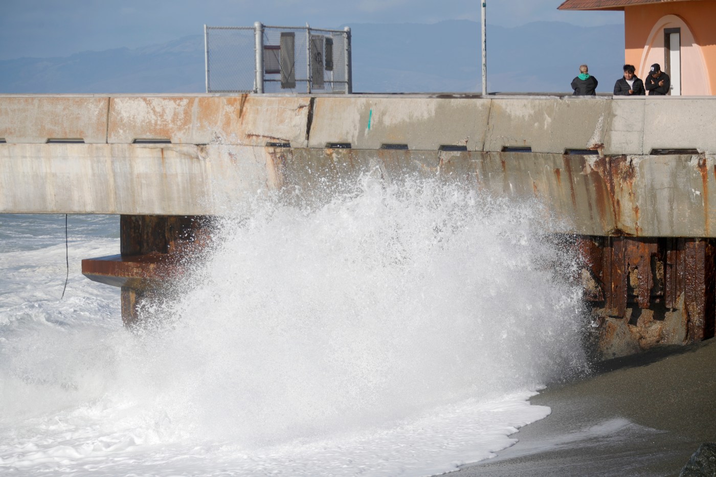
Now, attention shifts to the king tides and associated hazards at the beaches, Murdock said. The weather service has issued a warning for hazardous beach conditions and expects waves to reach average swells of 15 feet on Thursday, with some spots potentially exceeding 20 feet. Powerful rip currents are also forecasted.
“It’s not a good time to be going to the beach,” Murdock warned.
Looking ahead, the region is expected to dry out into next week, with clouds gradually giving way to blue skies as the weekend approaches. The next significant chance of rain is expected late next week.
“We have good confidence that the rain will be widespread,” said Murdock. “How much of it we’ll get is still uncertain. We have a low-pressure system moving in from the south and another coming from the north.”
Forecasters are closely monitoring these systems to determine what the next storm may bring. Stay tuned for updates as more information becomes available.
https://www.mercurynews.com/2025/11/06/bay-area-weather-beach-hazards-king-tides-end-of-storm/